National-scale Mapping
National-Scale Mapping & Geodetic Services
In a tectonically active country like New Zealand, maintaining an accurate spatial framework is a continuous challenge. Earthquakes, slow-slip events, and localised subsidence constantly warp the land surface, impacting everything from property boundaries to coastal infrastructure.
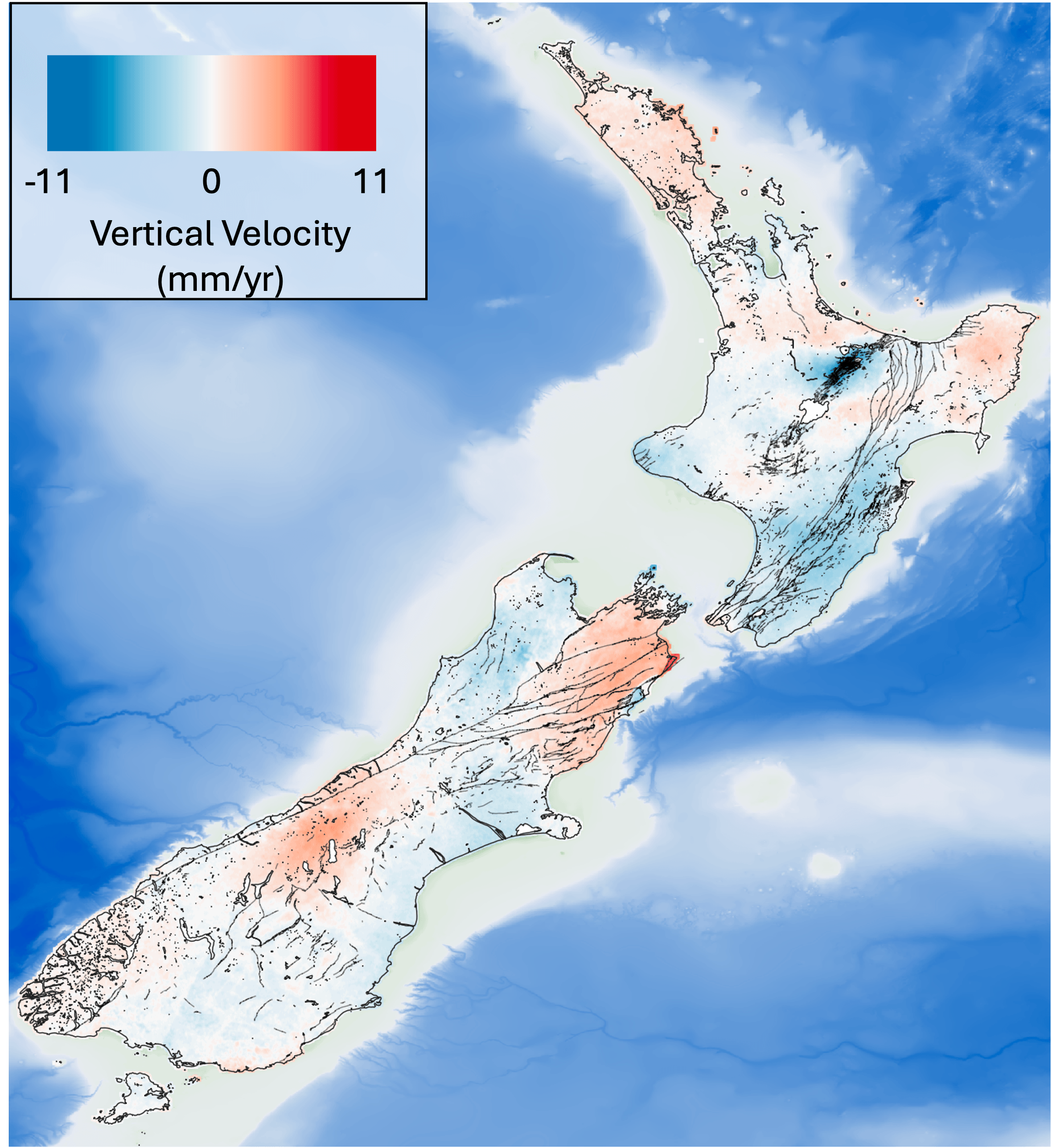
We utilise advanced national-scale InSAR processing to generate continuous, high-resolution deformation maps across the entire country.
Core Capabilities:
Absolute Vertical Land Motion (VLM): We calibrate relative satellite measurements with continuous GNSS/GPS station data to derive absolute VLM. This provides the critical "ground truth" needed to understand true subsidence and uplift rates.
Datum Corrections and Maintenance: Our nationwide deformation maps support national geodetic frameworks. We provide the dense spatial data necessary to model localised crustal deformation, aiding in datum corrections, coordinate updates, and the maintenance of a dynamic national datum.
Seamless Nationwide Coverage: Moving beyond localised studies, we process massive volumes of satellite data to deliver consistent, unified deformation models that span regional and national boundaries.